GFS Goes Full Zonal.. But Why?Added : Wednesday at 20:27 Right, first up you need to remember that a model is a model. Let's take the GFS ► as an example and the temperature is 3c at 18:00z in London. Based on the cloud cover and the lack of sunlight and cloud cover the GFS ► knows that by 19:00z the temperature will be 2c.
How? Well, that's down to a whole lot of physics. After all it knows that if there was 52% cloud cover then this would affect the outward radiation by a certain amount and that radiated heat from the upper clouds would affect the temperature at the surface too.
Just to give you a little example, this is just part of the GFS ► cloud forecast algorithm (it goes on for another 20 lines...) :-
At=(t−tp)/dt
Aq=(q−qp)/dt
Ap=(prsl−prslps×psp)/dt
b=1−(fs−ffs−u)1/2
q0=uqs
Ec=q0−qdt
Ec=qsdt(u−f)
Cg=M−qsft1+(fϵL2qs/RCpT2)+Ec
If you take a look at the chart for Friday, we have this :-
![]()
By Sunday we have this :-
![]()
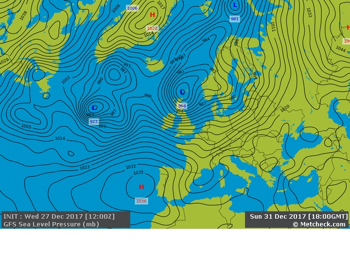
Into this time next week and we have this :-
![]()
Now this is important. We are now entering the new year and we reach a point where the rest of Winter is already giving us a few signs from above in the form of the polar vortex. If this becomes disrupted then the second half of winter may be cold, but if it continues with the strengthening phase then a wet and windy end to winter is on the way.
The problem is that there are no clear signs at all. The surface signals say that disruption is possible, but the polar vortex is holding firm and saying that wet and windy is the future.
The GFS ► model goes with what the physics packages say which should come as no surprise. But if you see any forecasts for a wet and wild winter or a cold and snowy winter this year then both parties are hedging their bets.
We are reaching a crux moment regarding the rest of the winter and we should have a clearer idea in the next couple of weeks.
METEOROLOGIST : CONFUSED |