Pulling In Colder AirAdded : Wednesday at 17:05 You have to give the GFS ► a decent hand on how it has handled the weather towards the end of this week and over the weekend. Here is the latest chart :-
![]()
You can see the low pressure system bringing rain across Southern England across parts of Northern Germany by tonight, but the GFS ► had the focus on the primary low to the Northwest of Scotland which we have highlighted.
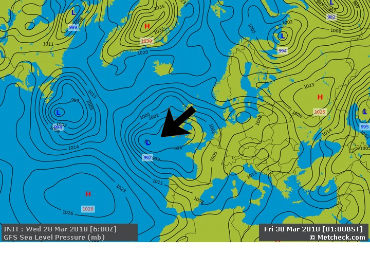
By tomorrow evening the low has swung South to here :-
![]()
If you check out the upper air temperatures on Friday you can see some residual cooler air across parts of Europe and Scandinavia :-
![]()
Into the weekend and the GFS ► does indeed bring this in from the Northeast :-
![]()
But any meteorologist will look at this and say "Sure, feeling chilly, but with upper air temperatures around -5 to -8c then any snow will always be for higher ground. As a rule of thumb you usually add around 10c to the 850mb temperatures to give you a rough idea as to the surface temperatures. After all, there aren't many places in the UK sitting at the 850mb level!
So, some sleety/snow showers for higher ground of East Scotland and Northeast England and also the risk of transient snow depending on the timing of arrival of frontal systems.
A good example of this is on Easter Monday. If you check out the precipitation forecast you can see the frontal system coming in from the Southwest :-
![]()
Because of the cooler air across the UK and clear overnight skies we see a widespread frost developing and this is what the frontal system is running into :-
![]()
But, the temperature rapidly increases as the cloud and rain approach, plus with a strong sun at this time of the year we find the snow risk diminishing quickly on Monday.
So a cooldown on the way over the weekend, but nothing too troublesome.
METEOROLOGIST : MARSH |