Looking At The Easter Storm RiskAdded : Saturday at 14:00 It's very early in the storm season for Britain and Ireland, but the next 36 hours or so do see the potential for some scattered thunderstorms to break out over central and southern parts of the country as low pressure to the west and southwest sinks southwards.
The risk begins to increase this afternoon across southwest England, thanks to a combination of the higher regions of Dartmoor and Exmoor and sea breeze convergence zones setting up:
![]()
Higher resolution models are also picking up on the risk of some showers breaking out over parts of the Midlands and southern England. However, it is anticipated that any storms that do form, whilst they could be quite heavy for a short time, they will tend to die out fairly quickly because of a lack of shear and moisture:
![]()
![]()
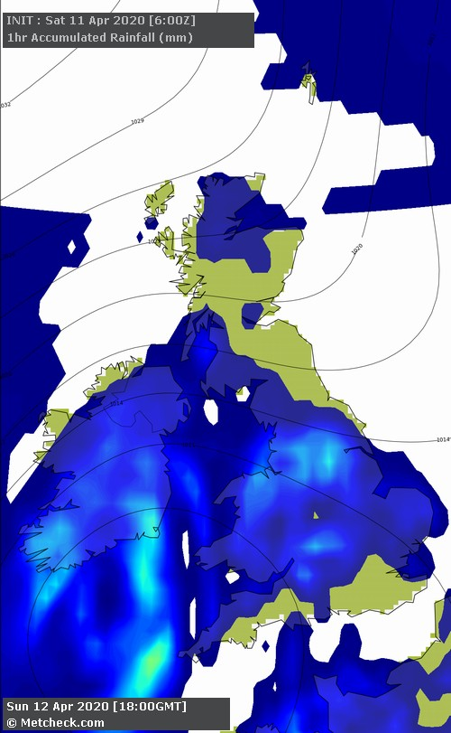
Easter Sunday offers a higher storm risk across England and Wales thanks to a combination of falling pressure, increased moisture and wind shear. CAPE values across England reach reasonable levels for a time in the warm air mass before this is moved away to the south later in the day:
![]()
There remains some uncertainty over the extent of showers and potential thundery activity with the models diverging quite noticeably. For example, here is the GFS ► for Sunday late afternoon:
![]()
The Arpege offers what we consider to be a more realistic view with more persistent rain out towards the west and scattered heavy showers breaking out further east:
![]()
The Arome model isn't too dissimilar to the Arpege model:
![]()
Regardless of the finer details regarding showers and possible thunderstorms, it's all change by Monday as a chilly north-easterly develops ahead of high pressure building back in to settle things down for the early part of next week:
![]()
METEOROLOGIST: BARBER |