A Different Week Of WeatherAdded : Saturday at 14:39 It feels like we have been talking about high pressure for several weeks now but all that is about to change as low pressure systems moving in off the North Atlantic become the main feature of our weather in the next few days.
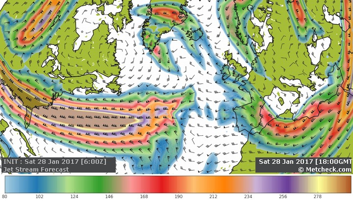
Let's start with a look at the jet stream across the North Atlantic and for today we can see a strong jet stream coming out of the United States but it hasn't quite made it to our shores:
![]()
Even by midweek it's struggling to push across, and it's only next weekend when it heads towards us, on a fairly southerly track:
![]()
![]()
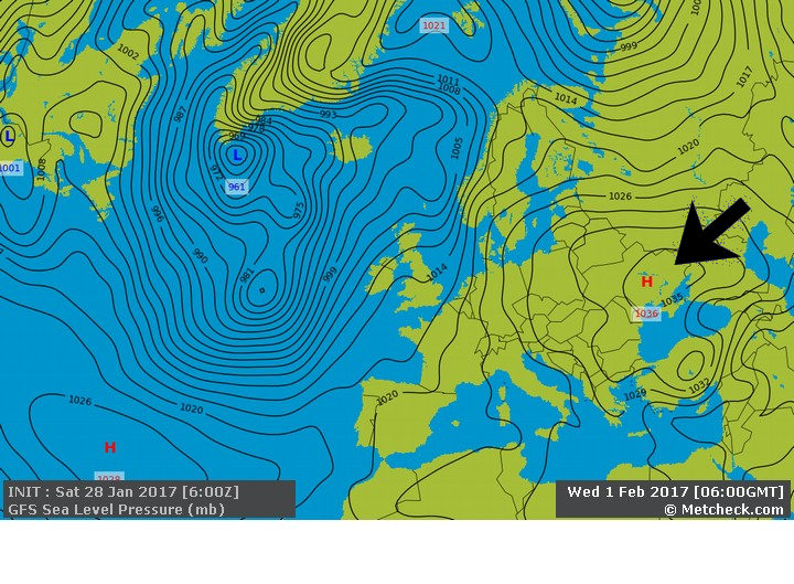
The reason that powerful jet takes so long to push across is that same area of high pressure that has dominated - it becomes very slow-moving whilst centred over western Russia and eastern Europe:
![]()
![]()
So although many parts of Britain and Ireland are caught in-between, it is going to be the Atlantic that has greatest influence this week as bands of rain push east or north-eastwards across the country from time to time:
![]()
![]()
The wettest of the weather for the next few days looks like being towards the north and west of the country with the south and east seeing less in the way of rainfall, as shown by the forecast accumulated rainfall by midweek:
![]()
Next weekend is then worth watching as that strong jet edges closer, bringing the potential for some lively weather with heavy rain and gales or severe gales perhaps becoming a notable feature...here's the GFS ► latest forecast for next Saturday:
![]()
And the ECMWF ► model:
![]()
A week to remember your brolly then but it will be milder than last week, especially for the southeast where it has been pretty cold recently:
![]()
So to summarise, a more active pattern than of late with all of us seeing some rain from time to time, but it could be that next weekend needs closely watching when the storm risk looks set to increase.
METEOROLOGIST: BARBER |