The Week AheadAdded : Sunday at 15:34 This week sees us moving into August, the eight month of the year and the final month of meteorological summer. Of course September into October can bring can fine and warm weather, but if it is heat that you are looking for then the clock is certainly ticking.
The early part of August is traditionally the warmest time of the year, but this year looks like going against that with the predominantly changeable and rather cool conditions set to continue. Here is today's synoptic chart:
![]()
Low pressure well and truly in charge of the weather with showers or longer spells of rain push east/northeast across many regions. So how will this week pan out? Let's start by taking a look at the forecast charts for Monday and Tuesday:
![]()
![]()
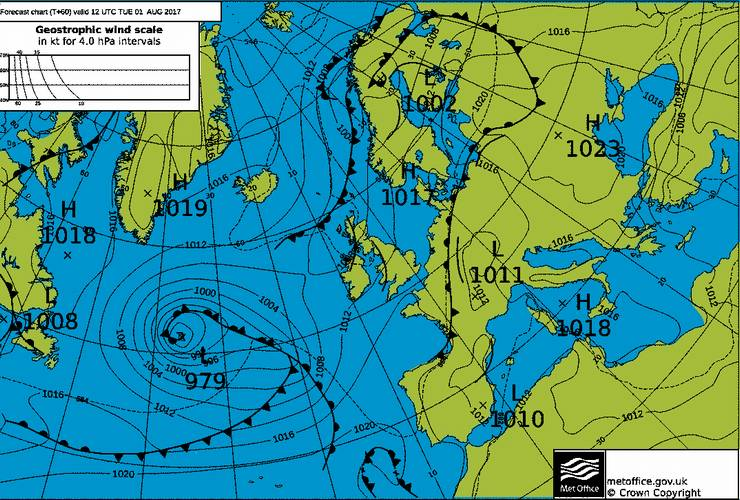
We can see how the weekend low pressure system has drifted away to the northeast and this opens up a window for a drier and brighter spell of weather to develop, especially towards the south and southeast. There will still be some showers around, but these will tend to become more confined to northern and western regions. In the best of the sunshine towards the south temperatures will recover too so a big improvement on recent days:
![]()
However the good news ends there as by Wednesday the next Atlantic low pressure system moves in bringing wet and windy weather with it:
![]()
Winds around exposed coasts could gust up to 50 mph:
![]()
With plenty of rain around too:
![]()
This then sets up a cool and showery end to the week with low pressure once again dominating proceedings:
![]()
To summarise then and for most places it will be another changeable week. There will be some brighter and warmer conditions around across southern and south-eastern regions during the first part of the week before the next Atlantic low steams in to bring an unsettled second half of the week.
METEOROLOGIST: BARBER |