Temperatures yesterday peaked at 35.2°C in Writtle, Essex, making it the seventh day of 2026 to record a maximum temperature of 35°C or above. That means this year has already comfortably surpassed the previous record of five such days, set in both 1976 and 2020.
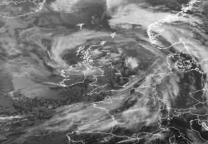
Today won't make it eight as a weakening cold front pushes south-eastwards introducing cooler and fresher air from the northwest. That front lies across many parts of Wales, central and eastern England this morning bringing a cloudy start to the day, although any rain will be light and patchy. Further southeast it is a fine and warm start and, although the cloud band will continue to edge south-eastwards through the day, the far southeast of England is likely to remain fine and very warm with top temperatures around 28°C or 29°C.
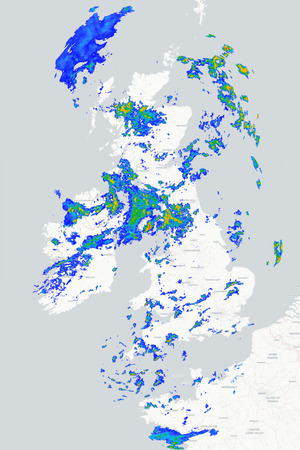
Further north, and in the wake of the cold front, it is a bright start for many but showers are affecting northern and western parts of the UK and Ireland with some heavy at times, particularly across Scotland. These showers will continue through the day, perhaps merging into longer spells of rain for a time in the far north before becoming more scattered this afternoon. It will be noticeably cooler here with temperatures reaching only the high teens or low 20s at best.
The weak cold front finally clears southeast England this evening and tonight and, whilst showers continue around northern and western coasts, it will become fine and clear for many. With a cooler air mass now in place it will be a much fresher night with temperatures in rural parts of central and northern Britain falling into single figures. Tomorrow is then set to bring a mixture of sunshine and showers to the north and west whilst much of England and Wales remains fine and dry, although temperatures will be lower than those experienced in recent days.
METEOROLOGIST : BARBER
|