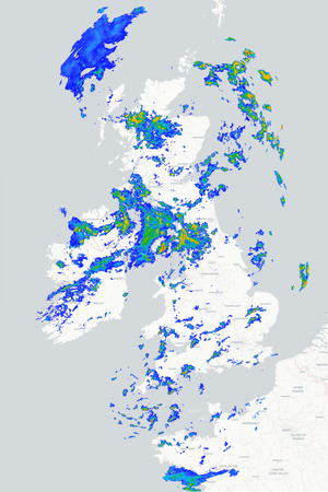
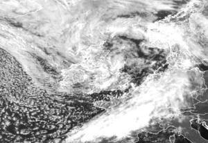
We're back to a familiar north/south split in the weather across Britain and Ireland today as an Atlantic frontal system brings rain, followed by showers, to the north, whilst the south is once again fine, dry and increasingly warm.
For many parts of Scotland it is a dull and wet start to the day with some locally heavy and persistent spells of rain, whilst outbreaks of rain are also affecting parts of Northern Ireland and northwest England, with a few drizzly outbreaks across Ireland and west Wales. The bulk of the more persistent rain will clear away to the northeast through the day, allowing brighter conditions to develop in its wake, but further scattered showers will break out this afternoon and a few of these could be heavy.
Meanwhile, for many central and southern regions of the UK it will be another dry day and, although there will be some cloud at times, there will also be plenty of sunshine, with the best of it reserved for southeast England. Top temperatures today will range from the high teens in the far north, the low-20s across many other northern and western regions, to highs of 26°C to 30°C across central and south-eastern England.
Further bursts of rain will develop across the northwest of the UK tonight but for many other regions it will be a mainly dry night with clear spells, although some mist and low cloud may form in places. Tomorrow then sees a continuation of the north/south divide with northern regions seeing a band of rain edging slowly south-eastwards, whilst many parts of England and Wales remain fine and dry. The best of the sunshine and the highest temperatures will once again be found across East Anglia and southeast England where maximums in the low to mid-30s are again possible.
METEOROLOGIST : BARBER GHX Risk Charts ► Humifeel Charts ► Radar ► Visible Satellite ► |



 Bore da, it’s a cloudy morning but the odd patch of blue sky keeps appearing as the sou...
 Good morning all.
It's been a beautiful start to the day with the odd small cloud driftin...
Good morning all.
It's been a beautiful start to the day with the odd small cloud driftin...