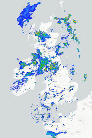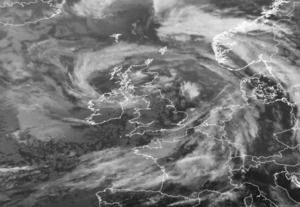
Tuesday will bring a rather mixed start across Britain and Ireland as a cold front moves eastwards across the country, bringing a short spell of heavy rain to some areas before gradually clearing away into the North Sea. Behind the front, a fresher airmass will spread across the country, bringing brighter skies but also a scattering of showers, particularly across northern and western areas.
Tuesday morning starts mild in many regions with with a narrow but potentially quite intense band of rain extending from eastern Scotland through northern England, Wales and down into southwest England. Some heavy bursts are likely as the front moves eastwards, although conditions should improve fairly quickly from the west as that front clears away to the east during the morning to leave plenty of dry and fine weather this afternoon.
Scotland, Ireland and Northern Ireland will see a mixture of sunny spells and showers today, these most frequent across western Scotland where some could be heavy, but some showers will make their way into parts of northern England and North Wales this afternoon. Top temperatures will reach around 13°C to 15°C across Scotland and Northern Ireland, 16°C to 18°C across many parts of England and Wales but perhaps as high as 20°C or 21°C across south-eastern England.
Showers towards the north and west this evening will tend to ease overnight leaving much of the country dry with some clear spells developing and temperatures dropping lower than they did last night. A few showers will continue across the far north and west of Scotland, but even these should become more scattered later in the night as thickening cloud and strengthening winds arrive. This takes us into an increasingly windy day across the north and west tomorrow as coastal gales develop along with heavy rain in the northwest later in the day but for many parts of England and Wales it should stay largely dry and bright.
METEOROLOGIST : BARBER
|



 Good morning,
Maximum temperature that I recorded yesterday 18.0c,
Minimum night temper...
Good morning,
Maximum temperature that I recorded yesterday 18.0c,
Minimum night temper... Good Morning from Honiton.
If you’re heading out early today, you might want to grab an...
Good Morning from Honiton.
If you’re heading out early today, you might want to grab an... Good morning from Jersey
Wet and windy early morning . This should improve by late morn...
Good morning from Jersey
Wet and windy early morning . This should improve by late morn...