Dry Start To NovemberAdded : Yesterday at 10:00 November looks set to begin on a largely settled note across the UK and Ireland with high pressure keeping much of the country mostly dry through the coming week :-
![]()
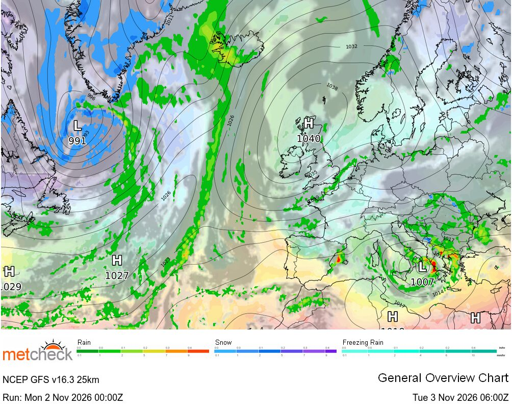
That dry outlook extending across many parts of central and northern Europe in fact with the Atlantic held at bay. So for this week it's very much a case of high pressure remaining influential across the UK and Ireland, bringing plenty of dry weather, variable cloud and some brighter spells.
With the high generally positioned to our north or northeast, a cooler easterly airflow looks likely at times, although temperatures shouldn't be particularly unusual for early November. Mist, fog and stubborn low cloud could also feature, especially where winds fall light, but overall it looks a fairly quiet opening to the month.
So is there any sign of a breakdown? Well. not in the reliable timeframe it seems. Looking at the charts for next weekend and whilst there is some broad agreement on low pressure remaining active across the Atlantic, there is disagreement over how close these systems get to the UK.
The GFS ► maintains a substantial area of high pressure across Scandinavia and northern Europe, with Atlantic depressions largely held to the west :-
![]()
The ECMWF ► also keeps the main Atlantic low pressure systems away from our shores, although its positioning of the high and the associated upper-air pattern differs somewhat. Interestingly, the AIFS solution also maintains a ridge of higher pressure close to the UK, suggesting that despite the Atlantic becoming increasingly active, there is still considerable resistance to an outright return to unsettled conditions :-
![]()
![]()
Looking further ahead into the second week of November and the uncertainty increases, with the models offering differing solutions. However, the common theme remains one of high pressure proving difficult to shift, despite an increasingly active Atlantic. So, for now at least, there's little sign of a convincing breakdown, although as yesterday demonstrated, things can change rather quickly beyond T+240!
METEOROLOGIST : BARBER |



 Limón 22mm/hr


 Queensland 141/hr


 Glasgow Ai... -2°c