Trailing Frontal SystemsAdded : Thursday at 10:05 Sometimes, you might hear forecasters saying that a front is "dragging its heels" or "slowly edging away to the Southeast." This is usually a slow moving frontal system which is associated with a low pressure system to the North and cooler air moves in slowly from the Northwest.
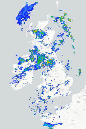
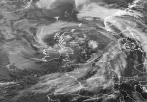
We have a similar scenario to this later this week, low pressure to the Northwest, frontal system wrapped around it with a slow moving front moving Southeast across the UK :-
![]()
Exciting right? Well, these systems can actually bring some rather interesting weather. In this case, we have cooler air to the Northwest, we also have much milder and more humid air to the South. More interesting though is what is going on above the front, here is the jet stream for later tonight :-
![]()
That's a rather active jet! The core though remains to the North of the front, otherwise we would be looking at a low pressure system developing quickly on the front, but at the same time we have a thing called upper level divergence taking place. Don't roll your eyes!
Upper level divergence simply means that the wind at height is moving quicker than lower level air, when this happens, it creates a sort of vacuum above the surface and the lower level air moves in to replace it and subsequently starts to rise.
So, low pressure, rising air and contrasting airmasses.. the result? Yup, rain...
![]()
As a result, this front likely to turn heavy for a time as it moves Southeast and you might even see some narrow bands within the system where the air is rising fastest in the form of squall lines.
AROME shows this up well with an active front clearing Southern and Eastern areas tomorrow morning with some stronger winds ahead of it and a change to cooler, calmer conditions behind the front :-
![]()
![]()
So, slow moving fronts aren't always the boring features you may think they are...
METEOROLOGIST : MARSH |